
View From Bimberi Peak - ACT/NSW State Border
Bimberi Range, Namadgi National Park, ACT, Australia
March 18, 2006 - 07:26 UTC (18:26 local time)

Loading panorama viewer ...
Configuring ...
© 2006 Simon Wheaton, All Rights Reserved.
Caption
View From Bimberi Peak - ACT/NSW State BorderBimberi Range, Namadgi National Park, Australian Capital Territory, Australia
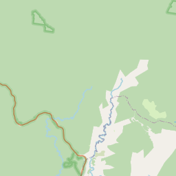
The trig station in this view is on the summit of Bimberi Peak, which at 1913 metres (6276 feet) is the highest point in the Australian Capital Territory (ACT), and is only 318 metres (1043 feet) below Australia's highest mountain, Mount Kosciuszko. Bimberi Peak is located on the western border of the ACT, with New South Wales (NSW) on the other side of the border.
On the first day of January 1901, the colonies of New South Wales, Victoria, South Australia, Queensland, Western Australia and Tasmania joined together in a new Commonwealth of Australia. The selection of a site for the National Capital for the new nation was not to be easy. Both before and after Federation there was much public bickering about what and where a federal territory and Seat of Government should be. When the constitution for the Commonwealth of Australia was being negotiated between the colonies, Melbourne and Sydney each wanted to become the capital. The new Constitution directed that the seat of government should occupy its own Territory in New South Wales and said that the Parliament must choose a site at least 100 miles (160 kilometres) from Sydney and that the Parliament would sit in Melbourne until a new parliament house was built in the new capital.
The Australian Government took possession of 2357 square kilometres (910 square miles) of land from New South Wales in 1911 to form the Australian Capital Territory as the site for the Australian national capital. That capital, Canberra, lies between Sydney, 307 kilometres north-east, and Melbourne 655 kilometres south-west. The western boundary of the territory follows the watershed of the Brindabella Range, a northern extension of the Snowy Mountains. The southern and western parts of the territory are mountainous, reaching a maximum height of 1913 metres (6276 feet) at Bimberi Peak. In the northeastern section there are broad valleys between rounded hills. The territory is located some 50 to 100 kilometres (30 to 60 miles) from the coast. Its rugged topography leaves only about 775 square kilometres (300 square miles) suitable for urban development.
The present site was chosen in 1908. In 1911 an international competition was held, and Canberra was begun. The Federal Government officially moved there from Melbourne in 1926. At first the Public Service continued to be administered from Melbourne, but the various departments were gradually moved to Canberra over the years. The territory was initially known as the Federal Capital Territory (FCT). In 1938, the territory was formally named the Australian Capital Territory.
The original plan for Canberra devised by Chicago architect Walter Burley Griffin has been realised brilliantly. Capital Hill is the site of today's Parliament House, which is a major feature of Burley Griffin's "land axis", a line running from Bimberi Peak through Red Hill and Capital Hill, across Lake Burley Griffin, then up Anzac Parade to the Australian War Memorial and Mount Ainslie.
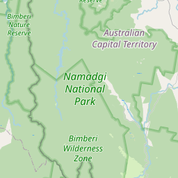
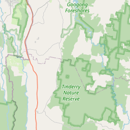
This view is taken from the ACT side of the border, in Namadgi National Park. Namadgi was proclaimed as a National Park in 1984. Namadgi National Park is located in the southwestern part of the Australian Capital Territory, bordering Kosciuszko National Park in New South Wales. It lies approximately 40 kilometres (25 miles) southwest of Canberra, extended in 1991, it now covers 106000 hectares or 45 per cent of the ACT. The park protects part of the northern end of the Australian Alps with its spectacular granite mountains. Its habitat ranges from grassy plains over snow gum forests to alpine meadows. The fauna is also varied: Eastern Grey Kangaroos, wallabies, wombats, magpies, rosellas, and ravens are commonly seen.
Among other things, Namadgi contains the most northerly sub-alpine environment in Australia. The Corin, Bendora and Cotter dam catchments, which supply the bulk of Canberra and Queanbeyan’s drinking water, lie mainly within Namadgi. The water catchment area of the park supplies approximately 85% of Canberra's water. Corin Dam, part of the Canberra water supply system, can been seen in the valley below Bimberi Peak in this photo. This close proximity of clean and reliable water flowing from largely undisturbed catchments was a major contributor to the decision to choose the location of Canberra as Australia’s capital.
This area of Namadgi National Park is called the Bimberi Wilderness. The Bimberi Wilderness surrounds Bimberi Peak and extends into NSW, where it is at the Northern end of the NSW Kosciuszko National Park. Notwithstanding the January 2003 bushfires, it contains some of the least disturbed ecosystems in the Australian Alps and, as such, is of very high conservation value.
The actual ACT/NSW border comes up the mountain on the other side of the trig station, along the ridgeline to the right of the trig station, and then along the ridgelines and peaks off into the distance. When looking at the trig station, ACT is on the left side of the photo, with NSW to the right side behind the ridgeline.
LINKS
- Peace River Studios: http://www.peaceriverstudios.com/
- Acratech Inc.: http://acratech.net/
- Kekus Digital: http://www.kekus.com/
- Pano2QTVR: http://www.pano2qtvr.com/
Location
Australia - New Zealand / Australia
Lat: 36° 40' 33" S
Long: 148° 47' 25" E
Elevation: 1913
Precision is: High. Pinpoints the exact spot.

Equipment
HARDWARE
- Canon EOS 350D DIGITAL (EOS Digital Rebel XT) Camera
- Canon BG-E3 Battery Grip
- Canon RS-60E3 Remote Switch
- Canon EF-S 10-22 mm f/3.5-4.5 USM Zoom Lens
- Canon EW-83E Lens Hood
- Peace River Studios 3Sixty Panoramic Camera Mount
- Manfrotto 338 Levelling Base
- Acratech Universal Cork Top Quick Release Camera Plate
- Acratech Ultimate Ballhead Tripod Head
- Gitzo G1227MK2 Mountaineer Carbon Fiber Tripod
- Inca Hotshoe-mount Dual Spirit Level
- SanDisk Extreme III 1GB CompactFlash Memory Card
- NextoDI Nexto-CF ND-2500 60GB Portable Storage Device
- Garmin eTrex Vista C GPS Receiver
- Burton Snowboards F-Stop Camera Backpack
SOFTWARE
- Adobe Photoshop CS2 (RAW Image Conversion, Image Editing and Adjustments)
- Kekus Digital PTMac (Panorama Stitching)
- Helmut Dersch's Panotools (Panorama Stitching)
- Kekus Digital XBlend (Panorama Blending)
- Andrew Mihal's Enblend (Panorama Blending)
- Thomas Rauscher's Pano2QTVR (Blended Panorama Image to QTVR Movie Conversion)
EXPOSURE
- Panorama Type: Cylindrical
- Number of Images: 18 Images x 1 Row
- Focal Length: 10mm (16mm at 35mm film equivalent)
- Aperture: f/16
- Shutter Speed: 1/125 second
- Sensor Sensitivity: ISO 100
Behind the scene : Choosing a Location
This panorama was actually my fourth choice of location to shoot from. I had four options of locations to shoot for this event, the first 3 choices did not work out, leaving me with this photo as my only choice for submission.My first choice of location was Cape Howe, on the coast where the New South Wales and Victorian border meets the Pacific Ocean. Located within the Nadgee Nature Reserve on the NSW side of the border, and within Croajingolong National Park on the Victorian side of the border, reaching Cape Howe requires a 2 day hike in and out, and my work commitments and lack of transport for that period of time ruled out this option.
My second choice was Mount Youngal, in the NSW Kosciuszko National Park, which I thought might overlook the Murray River southern banks that form the NSW/Victorian border. Upon reaching the summit of Mount Youngal on the Sunday, after a 2 hour/11 kilometre/1000 metre vertical rise mountain bike ride up a closed-to-vehicles dirt access road, with my 12 kilograms of camera pack and water, with only 2 hours of sleep and a 3 and a half hour drive to get there, having arrived home at 1am in the morning after spending 14 hours the day before to shoot my forth choice of location, I found that the view was not what I expected, with buildings on the summit and trees blocking the view, so I did not take a photo.
My third choice was The Pilot, another peak in the NSW Kosciuszko National Park that also overlooks the Murray River South Bank which forms the NSW-Victoria border. After mountain bike riding the 2 previous days, being exhausted from doing so, and having my rear disc brake pads on my mountain bike wearing out at the start of the descent from Mount Youngal the day before, I decided not to ride to take a photo from the summit of The Pilot on the Sunday.
My fourth choice was Bimberi Peak, on the Australian Capital Territory/New South Wales border. I rode into Bimberi Peak on the Saturday, the first day of my shooting schedule, to shoot this fourth choice as a backup in case the second and third choice locations didn't work out. This turned out to be the only photo I actually shot for the WWP event, and therefore the photo I had to use.
On the Saturday, for the Bimberi Peak shoot, I drove the car for 210 kilometres/3.5 hours, rode my mountain bike for 33 kilomtres/4.5 hours, and hiked for 7 kilometres/2.5 hours.
 Tap or click the zoom icon in the bottom right corner of the picture to switch between in-page and fullscreen view