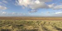

Southport Dunes
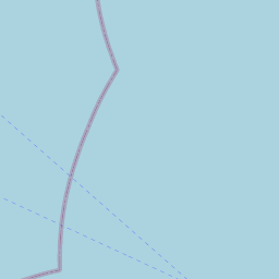
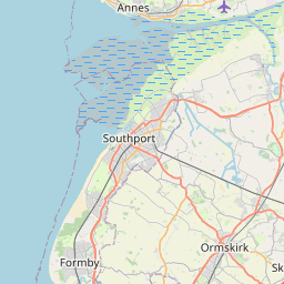
Weld Road, Birkdale, Southport, Merseyside, England, UK
December 9 2006 - 13:05GMT

Loading panorama viewer ...
Configuring ...
© 2006 Rodrigo Alarcón-Cielock,
Some Rights Reserved.

Caption
The Sefton coastline comprises of soft and granular estuary deposits of sand, silt, clay and peat. There are no outcrops of rock on the shoreline. Hence, the forces of nature readily mould it, so the shoreline is constantly changing in response to the fluctuating influence of wind and water and as a result of human activity. Its overall shape derives from two major river estuaries, the Mersey and the Ribble. At Crosby and Southport the shoreline has been partly fixed in place by coastal defence work. However, the natural forces remain at work and sand drift at Crosby is tending to bury parts of the sea wall, whilst sand dunes are developing in front of the sea wall north of Weld Road, Birkdale.
The sands dunes system stretches from Altcar to Weld Road, only being interrupted by Shore Road at Ainsdale. The dunes between Shore Road and Weld Road are further divided by the Coastal Road separating the frontal and mobile dunes from the rear dunes. This reduces the average width of the dune system to approximately 200m. To the south of Weld Road, from where this panorama was taken, sees the development of marshland, slack and embryo dunes in front of fixed dunes, stretching roughly 3km south. The southern end reaches an abrupt finish where the barrier of parking zone extends.
The Sefton coastline is home to a number of rare species, such as the Natterjack Toad and native red squirrels, and contains the most extensive and developed dune system in England. As a result, large sections are designated as Sites of Special Scientific Interest, EU Special Protection Areas and Special Areas of Conservation. There is a footpath that passes through them all, as well as a variety of Local Nature Reserves and English Nature and National Trust properties.


Equipment
- This panorama was created on a very windy day using 8 sets of 3 bracketed phothographs each, in RAW format, taken at -2, 0, +2, at 11mm/f22 to create 8 HDR photgraphs. The lens used was the Tokina 10-17mm.
- Camera: Canon 350D
- Lens: Tokina 10-17mm at f22
- Panohead: Nodal Ninja 3
- Tripod: Sleek Pro 500DX
- Software: CS2, FDR Tools, PTGui and Pano2QTVR
 Tap or click the zoom icon in the bottom right corner of the picture to switch between in-page and fullscreen view