
Cancun Airport Tower Part 1
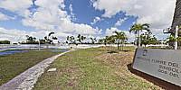
First Airport Tower, Cancun, Quitana Roo, Mexico
September 17, 2011, 11:15 am (-6 GMT)

Loading panorama viewer ...
Configuring ...
© 2011 Dave Albright, All Rights Reserved.
Caption
The February 5, 1973, maiden flight of a DC-6 4-engine propeller-driven Mexicana Airlines airliner, tail number XA-MUK, was a success, as were the other successful flights. The first plane left Mexico City at 9:00 am and landed at the original Cancun air strip at 12:20 pm. The Mexicana Airlines flights became more frequent with DC-6s, with 72 passengers, later 727s, with 160 seats, and DC-10s, with a capacity of 311 passengers.To see the current Cancun International Airport information see part 2.
Source information about Cancun Airports
Our Travel Host in Mexico
Nodal Ninja Ultimate R1 and R10
Pano2VR
PTGui
Krystal Hotel, Hotel Zone 9.5km Cancun, Mexico.
Our Travel Host in Mexico
Nodal Ninja Ultimate R1 and R10
Pano2VR
PTGui
Krystal Hotel, Hotel Zone 9.5km Cancun, Mexico.
Location
Lat: 21° 7' 48.53" N
Long: 87° 50' 46.96" W
Elevation: Elev 36 feet elevation above Mean Sea Level
Precision is: High. Pinpoints the exact spot.
Equipment
Canon 500D, Sigma 8mm f/3.5, Monopod, Fanotec Nodal Ninja Ultimate R1 Ring Mount Pano Head, 4 Raw images +5 deg tilt up, Adobe Raw Converter 6, Adobe Photoshop CS5, PTGui 9.1 beta 2 Pro, Pano2VR 3.1.0 Panoramic Image Converter (Rev 1777/4.7.2 August 11, 2011).
 Tap or click the zoom icon in the bottom right corner of the picture to switch between in-page and fullscreen view