
Man's limits ...
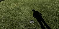
Canyon Country Park, Canyon Country, California, USA
March 27, 2011, 10:20 am (5:20 pm UTC)

Loading panorama viewer ...
Configuring ...
© 2011 Pat Swovelin, All Rights Reserved.
Caption
As mankind evolved any individual's knowledge was limited to what he could see and do personally. At some point language evolved to the point that humans were able to tell others about things they'd seen and done when away from the group and thereby increase the group's knowledge.Time passed.
A lot of time passed.
Eventually technology increased step by step until computers were invented with the ENIAC. Oh yeah, now we're talkin'! Assuming you define "talking" as being done by programming a room-filling computer 1 wire at at time then, yes, they were talking.
More time passed and ARPANET, what would eventually become the Internet we know today, was invented by MIT and DARPA. Then Tim Berners-Lee made the leap and invented the World Wide Web. Now we were really talking.
While all of this was happening corporate/government-owned room-filling mainframe computers were being supplanted by personal computers for the average person. Then along came Gordon Moore, Intel co-founder, who postulated. in 1965, that hardware speed would double and cost would halve every 2 years. Since then Moore's Law, as it's known, has driven the PC industry until today when with a few taps on the screen of my iPad it can not only show me where it is but that I'm standing beside it in Canyon Country Park. While it has more computing power than all of the Apollo spacecraft that went to the Moon, combined, not just the ones that landed on it, it's a waste of computing power when I could simply lift my head and have a look around and see where I am.
Ain't technology grand?
So being on the Internet is like VR ... you're there but you're not, just like me and my iPad.
Location
Lat: 34° 25' 13.27" N
Long: 119° 27' 24.29" W
Elevation: 1,610 feet
Precision is: High. Pinpoints the exact spot.
Equipment
Canon EOS 450D (Digital Rebel XSi), Sigma 8mm F3.5 EX DG Circular Fisheye lens, Nodal Ninja R-1 panohead, Manfrotto 190XPROB tripod, Yong Nuo YN-128 wireless remote control, ISO 100, f8, 1/200 second exposure, Adobe Bridge CS5, Adobe Camera Raw 6.3.0.79, Adobe Photoshop CS5 Extended, PTGui Pro 9.0.3, Pano2VR 3.0, NBNC, PDL
 Tap or click the zoom icon in the bottom right corner of the picture to switch between in-page and fullscreen view