
French Civil Aviation was Born Here
Toulouse-Montaudran, France
September 20, 2011, 15:00 local time

Loading panorama viewer ...
Configuring ...
© 2011 Michel Thoby, All Rights Reserved.
Caption
History of the Toulouse-Montaudran AirfieldThe aerodrome of Montaudran was created in May 1917 to be the airfield where the airplanes built by the Latécoère factory that was nearby, were flight tested.
In 1918 this place was where the airline Toulouse-Marocco-Algeria established its starting point. This pioneering airline was created by Pierre-Georges Latécoère who hired discharged pilots and mechanics when the first World War had ended. They flew military aircraft that had become useless and obsolete in the French military stockpile.
The Latécoère airline was further extended in 1925 to West Equatorial Africa and to South America in 1928.
The Compagnie des Lignes Latécoère was subsequently merged into the Compagnie Générale Aéropostale in 1927 and in the Compagnie Air France in 1933.
Air France used the former Latécoère facilities and the Montaudran airfield for the maintenance of e.g., jet airplanes until 2003 before moving this activity 25 miles north on the edge of the Blagnac airfield. The Montaudran aerodrome became disused...
The heroic history of this place shall be remembered as it is now displayed to the public in a museum "Espace Mémoirede l'Aéropostale" installed in the old Latécoère buildings.
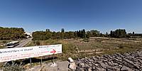
One can see on the panorama that the venerable runway has been willingly partly destroyed and new buildings are being erected...
Location
Lat: 43° 34' 18.19" N
Long: 1° 28' 42.81" E
Elevation: 149 m
Precision is: High. Pinpoints the exact spot.
Equipment
Canon EOS 5D Mk2 @ (ISO 100 & 1/500)Canon EF 8-15 mm f4 L Zoom Fisheye lens @ 12 mm & f/8
Manfrotto 269HDB-3U: 7.6 m high stand + Home-made Camera support (bracket)
PTGui Pro; Pano2VR; Photoshop CS4
 Tap or click the zoom icon in the bottom right corner of the picture to switch between in-page and fullscreen view