
Crossroads, Evolution of
Voorburg, The Netherlands
Tuesday, September 21, 2010, 1:32 pm (local time)

Loading panorama viewer ...
Configuring ...
© 2010 Arie P. de Ruiter, All Rights Reserved.
Caption
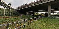
The Prins Clausplein seen from below. One of the larger intersections in the Netherlands.
Equipment
Nikon D300 + Nikkor 10.5mm fisheye + Nodal Ninja 3
Photoshop CS5 + PTGui Pro 8.3.10 + Pano2VR 2.3.4
 Tap or click the zoom icon in the bottom right corner of the picture to switch between in-page and fullscreen view