

Loading panorama viewer ...
Configuring ...
© 2004 Florian Bertzbach, All Rights Reserved.
Caption
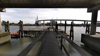
The Koehlbrand" is a channel of more than 400m width, connecting the southern and the northern part of the river Elbe. During the 14th and 15th century heavy storm tides divided the Elbe-Island "Gorieswerder" in two parts. The name "Koehlbrand" is the German translation of charcoal-burners, who merchandised charcoal to the passing ships. In 1908 the riverbed was moved 600m westwards and deepened to 8.5 meter in that time. The half-island "Koehlbrandhoeft separates the old and the new channel. With growing traffic the limit of ferryboats was reached with 6500 vessels per day. The growth of traffic was a result of the growing harbour and the container centre. Because of the costs the Hamburg Senat decided to build a bridge instead of a tunnel. In 1969 a competition was invited. Today's bridge is a construction of architect Egon Jux. Build between 1970 and 1974 the bridge is one of the most modern bridges of Europe. September 20th 1974 Bundespraesident Walter Scheel opened the bridge. Helmut Kern, representing the building owner, had the honour crossing first the Koehbrand by feet; he paid 10 silver-coins to the foreman, who had to polish his shoes as a kindness, following an old rule.
The cable-stayed fan arrangement bridge, with a totally length of 3940 m, lays on 75 pillars; the main span is about 325 m with a totally crossing height of 53 m. 88 cables are holding the main deck of 13,5m width, hanging on two 135 m pillars.
The cable had to be changed after 4 years because of corrosion: 17 million German Marks!
Today 30.000 vessels are crossing the landmark of Hamburg, the "Koehlbrand bridge", which is half of the traffic of Golden-Gate-Bridge.
Equipment
Nikon D100 digital SLR, Sigma 8mm fisheye, f9.0 at 1/250, mounted on custom-made adapter on a manfrotto 344BR, 43B platform and Proball 468RC2, stiched with ptgui 3.7beta1 / Autopano 1.03 enblend 1.3 ; PanoCube v 0.0292
 Tap or click the zoom icon in the bottom right corner of the picture to switch between in-page and fullscreen view