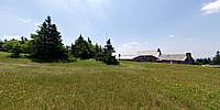
WWP Home arrow right This Event arrow right Indices: Alphabetical | Regional | Thumbnail | Map previousPrevious | Nextnext
event title
USA
portrait William M. Delabarre
Mt. Greylock
North Adams, Adams, Lanesborough, Cheshire, Williamstown and New Ashford, Massachusetts, USA
mini manual

This should be a panorama image.

If you can read this, something went wrong.
We support these player technologies:

With ... you can view ...
Apple QuicktimeVR
(part of Quicktime)
all contributions
Adobe Flash Player 10.1 or newer most (not all, some contributions are QTVR-only due to historical reasons)
Javascript + HTML5 / WebGL many, but depends on photographer's choice of file upload (newer event = more likely to work) and your device's capabilities. You may experience slow playback, distorted images or unexpected browser quitting if there is only limited memory/GPU power available.
[?]
Copyright © 2012 William M. Delabarre, All Rights Reserved
Previous panorama: Richard CrowestfullscreenA-Z Regions ThumbnlsShow in MapNext panorama: Jan Doumen

On top of Greylock is the Veterans War Memorial Tower, and Bascom Lodge http://bascomlodge.net/ that was built by the Civilian Conservation Corps. Mt. Greylock is the highest point in Massachusetts, the first wilderness state park in Massachusetts, and is part of the Appalachian Trail. Natural heritage is our most precious jewel.

Location Map Geographic Coordinates:
Latitude: 42° 38' 13.87" N
Longitude: 73° 9' 59.44" W
Elevation: 3492
arrow Show at MultiMap.com [what is MultiMap?]
arrow Show at Google Maps [what is Google Maps?]
arrow Show in Google Earth* [what is Google Earth?]
* requires Google Earth
installed on your computer

Date/Time:
06/21/2012 - 11:27 AM

Equipment:
Nikon D7000, Nikkor 10.5mm Lens, Kaidan Quickpan with standard bracket / Photoshop, PTGui, Pano2VR


text
WWP Home arrow right This Event arrow right Indices: Alphabetical | Regional | Thumbnail | Map previousPrevious | Nextnext