WWP Home arrow right This Event arrow right Indices: Alphabetical | Regional | Thumbnail | Map previousPrevious | Nextnext
event title
Europe
portrait Joakim Löber
Disused Road
Near Eppstein/Taunus, Hessen, Germany
mini manual

This should be a panorama image.

If you can read this, something went wrong.
We support these player technologies:

With ... you can view ...
Apple QuicktimeVR
(part of Quicktime)
all contributions
Adobe Flash Player 10.1 or newer most (not all, some contributions are QTVR-only due to historical reasons)
Javascript + HTML5 / WebGL many, but depends on photographer's choice of file upload (newer event = more likely to work) and your device's capabilities. You may experience slow playback, distorted images or unexpected browser quitting if there is only limited memory/GPU power available.
[?]
Copyright © 2010 Joakim Löber, All Rights Reserved
Kugelblick.de
Previous panorama: Jann LipkafullscreenA-Z Regions ThumbnlsShow in MapNext panorama: Serge Maandag

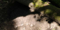
This street was built in the years 1843–1846 and replaced by a new one in the years 1975–76. For more than 3 decades, there has been no traffic on the old street and the forest is claiming its territory back.

Location Map Geographic Coordinates:
Latitude: 50° 7' 50.5" N
Longitude: 8° 24' 21.9" E
Precision is: High. Pinpoints the exact spot.

arrow Show at MultiMap.com [what is MultiMap?]
arrow Show at Google Maps [what is Google Maps?]
arrow Show in Google Earth* [what is Google Earth?]
* requires Google Earth
installed on your computer

Date/Time:
June 27, 2010 15:14 CEST

Equipment:
Nikon D300 with Nikkor 10.5mm, Novoflex VR-System PRO II, stitched with PTGui Pro (PC) and MakeCubic (Mac).


More Panoramas and information about the old street in Eppstein.

For contact information and more panoramas of Germany, check my personal website, Kugelblick.de

text
WWP Home arrow right This Event arrow right Indices: Alphabetical | Regional | Thumbnail | Map previousPrevious | Nextnext