

Loading panorama viewer ...
Configuring ...
© 2008 Michael Stoss, All Rights Reserved.
Caption
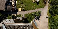
The Wienerwald is a forest area west of Vienna, Austria. Already in 1898 a lookout tower had been erected, together with an adjecent shelter house. This first tower burned down in 1927 due to the stroke of a lightning and another tower was built on the spot. When that one burned down in 1946, again caused by a lightning, only the shelter house was left for decades, extended to serve as an inn in 1954. In 2004 a new lookout tower was erected with a height of 22,5 m, offering a magnificent view. It is recommended not to cheat: first warming up at the tower, then cooling down at the inn :-) Further reading (german only):
http://de.wikipedia.org/wiki/Buchbergwarte
Location
Lat: 48° 12' 51" N
Long: 15° 56' 44" E
Elevation: 469
Precision is: Medium. Nearby, but not to the last decimal.
 Tap or click the zoom icon in the bottom right corner of the picture to switch between in-page and fullscreen view