
Minneapolis - "City of Waters"
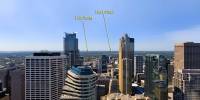
Hovering over Downtown Minneapolis, Minnesota, USA
06/18/2005 11:37 local time (CST)

Loading panorama viewer ...
Configuring ...
© 2005 Edward S. Fink, All Rights Reserved.
Caption
Originally named "Minnehapolis", literally, "City of the Falls", from the Dakota Sioux word "Minnehaha", meaning "laughing water" or falls, and the Greek "polis", meaning city. The "h" was later dropped and the city became simply Minneapolis, "City of Waters."While exploring "New France" in 1680, Father Louis Hennepin, the Belgian friar who had earlier discovered Niagara Falls found the only waterfall on the entire length of the Mississippi River, and named it for his patron saint "St. Anthony".
The 50' vertical drop of the Falls of St. Anthony is the reason Minneapolis exists today. It brought tourism, and later the lumber and flour milling industries eager to utilize the power of the falling water. Minneapolis became the "Flour Milling Capitol of the World" and during the industry's peak the Washburn Mill alone ground enough flour to make 12 million loaves of bread per day.
Although the lumber mills disappeared after the region's deforestation, and the flour mills disbursed as electricity eliminated the industry's reliance on water power, Minneapolis continued to thrive, and today is the largest city in Minnesota, the "Land of 10,000 Lakes", and one of the largest cities in the Midwest.
Other notable Minneapolis connections to "water":
There are 22 lakes in Minneapolis.
The Hennepin Ave. Bridge is on the site of the first bridge anywhere on the entire Mississippi River.
Minneapolis has more bridges across the Mississippi River than any other city on the river.
The Stone Arch Bridge is the only stone bridge to span the Mississippi River.
The Upper St. Anthony Falls Lock and Dam is the northernmost lock on the Mississippi River.
This panorama is one of a series shot for VRskytour
See other Minneapolis panoramas on my website at NEW-EDEN.COM
Equipment
Nikon D70, Sigma 8mm, Robinson R44 helicopter, Panorama Tools, PTGui, Enblend, PanoCube Plus, Photoshop. ISO 200, 1/800@f8, RAW
Behind the scene : how this panorama was made
Pilot John Lindstrom of Hummingbird Helicopters hovered over downtown Minneapolis while I used a monopod to lower the camera below the helicopter's landing skids and take 4 shots 90 degrees apart, pitched down about 30 degrees. The sky was shot at the airport after landing.The Nikon D70 only has an IR remote, which isn't too useful under the helicopter, but I found an inexpensive wired remote solution from Bear Island Trading Company BearIslandTC@nc.rr.com that let me use my camera instead of paying $150 per day to rent a bigger Nikon.
I was amazed that in the noisy, vibrating helicopter, with heavy headphones on, and the camera down beneath the landing skids, I could still tell when the shutter fired - I could feel the mirror bounce!
 Tap or click the zoom icon in the bottom right corner of the picture to switch between in-page and fullscreen view