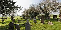

Churchyard of St. Mary's
Lower Gravenhurst, Bedfordshire, England
March 25, 2011, 13:54 UTC (13:54 local time)

Loading panorama viewer ...
Configuring ...
© 2011 John Houghton, All Rights Reserved.
Caption
The church of St. Mary, in Lower Gravenhurst, dates from the 14th Century and the churchyard is typical of the many disused churches scattered over England. The grounds where the faithful are buried are consecrated areas—set aside for sacred use in perpetuity by the Bishop of the diocese signing a Sentence of Consecration. The limits of the consecrated area aren't necessarily the whole churchyard and can be as small as a single grave.
Equipment
Canon 5DII + Canon 15mm fisheye lens. Nodal Ninja 5 on a Feisol CT-3441S - Traveller tripod. Stitched with PTGui Pro V9.
 Tap or click the zoom icon in the bottom right corner of the picture to switch between in-page and fullscreen view