

Loading panorama viewer ...
Configuring ...
© 2009 Alex Makienko, All Rights Reserved.
Caption
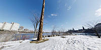
This pano was shot from Victoria Island, which is located on the Ottawa River in the heart of the Canadian National Capital. Now, as centuries ago, this island belongs to the Algonquin people who use it for gatherings, trade and celebrations. From this point you can see both sides of the Ottawa River - French and English. Looking downstream, on your left, you see the modern buildings of the Quebec city of Gatineau. The right bank is the Ontario side, where the City of Ottawa itself is located. Among other buildings that you can see, the Canadian Parliament with the Peace Tower dominating the city, the Parliament Library and the Supreme Court of Canada.
This spot is one of the examples of Canadian diversity – the Aboriginal, French and British origins join at this point.
I would like to thank my good friends Dave Lute and Rob Agnel who participated in this trip and photo-session.
Equipment
Nikon D80, Nikkor f2.8/10.5mmSoftware: PanoLab3D
 Tap or click the zoom icon in the bottom right corner of the picture to switch between in-page and fullscreen view