

Loading panorama viewer ...
Configuring ...
© 2007 Alexandre Duret-Lutz, All Rights Reserved.
Caption
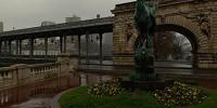
Pont de Bir Hakeim is a bridge of Paris on one side of a very thin island called île aux cygnes (swan island).
This spot offers a nice view of the Effeil tower.This is the morning, less than one hour after sunrise, with bad weather. The panorama was shot under a mild shower and I had to wipe the lens once during the shot (and of course once afterward).
Equipment
Pentax K10D with its 18-55 kit lens (32 shots).
Tripod with Manfrotto 303SPH panoramic head.
Equirectangular panorama generated with autopano-SIFT, hugin, enblend, and The Gimp.
QTVR movies built with Bruno Postle's erect2qtvr script.
 Tap or click the zoom icon in the bottom right corner of the picture to switch between in-page and fullscreen view