

Loading panorama viewer ...
Configuring ...
© 2005 Yasuhiro Fujimoto, All Rights Reserved.
Caption
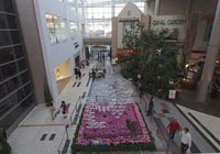
Kobe Harborland is a shopping and entertainment district along the waterfront of Kobe's port area, offering many cafes, restaurants, shopping malls, a ferris wheel and other forms of entertainment. It is another popular dating spot among young couples.Overview of Kobe City
Learn more about Kobe City Port Area
STUDIO LOOPS - Panoramas from Kobe.
Equipment
Hardware: Fuji S3Pro, Nikkor 10.5mm, Manfrotto/Bogen 303SPH, MDeVe aluminum video tripod.Software: Kekus Digital PTMac and Click Here Design CubicConverter.
 Tap or click the zoom icon in the bottom right corner of the picture to switch between in-page and fullscreen view