
Mark Twain on the Trinity
Fort Worth, Texas, USA
November 14, 2007 11am Central Texas Time (-6 UTC)

Loading panorama viewer ...
Configuring ...
© 2007 Pat Albright,
Some Rights Reserved.

Caption
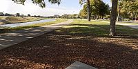
Mark Twain Bronze Statue – This life-size bronze statue was generously donated by the Red Oak Foundation and dedicated June 2007 . Seated along the Trinity River Twain shares enthusiasm for the joy of reading. Sometimes startling, but always inviting, we see children seated with Mr. Twain reading a page from his book.The other book on the seat is a 110 year old autographed copy of "Following the Equator a Journey Around the World" by Samuel L. Clemens copyrighted 1897 by Olivia L. Clemens. We identify with this book as we too have traveled around the world.
See more WWP at 360Texas.com
See the Mrotator U at work
See the Mrotator RingT8S
Pano2QTVR Pano2VR
PTGui
Easypano
See the Mrotator U at work
See the Mrotator RingT8S
Pano2QTVR Pano2VR
PTGui
Easypano
Location
Lat: 32° 44' 13.8" N
Long: 98° 22' 33.43" W
Elevation: 550 feet above mean sea level
Precision is: High. Pinpoints the exact spot.
Equipment
Canon 350d (Rebel XT), Sigma 8mm f3.5, RingT8S panorama head, Photoshop CS3, Easypano Panoweaver 5, Ptgui 7.3, Pano2QTVR 1.6.6 and Pano2VR beta 3.
 Tap or click the zoom icon in the bottom right corner of the picture to switch between in-page and fullscreen view