
The Seven Sisters Chalk Cliffs of Sussex
Birling Gap, Eastbourne, Sussex, England, UK
2007 January 14 13:00

Loading panorama viewer ...
Configuring ...
© 2007 Geoff Mather,
Some Rights Reserved.

Caption
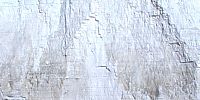
Low tide on the chalk bedrock looking at the Seven Sisters cliffs which line the Sussex coast.To the left is Birling Gap and then Cuckmere Haven (these cliffs form the Seven Sisters) and finally Newhaven.
To the right hidden around the headland is Beachy Head and Eastbourne.
On top of the headland, 50m high, is the Belle Tout lighthouse, no longer visible after having been "rolled back" from the crumbling cliff edge!
This Pano was taken on the 14th Of January 2007 hence the very low sun angle despite it being 13:00 UTC.
More information about the area is available at the Seven Sisters Country Park site, and a descripton of each of the ciffs is here on Wikipedia.
Location
Lat: 50° 44' 20.9" N
Long: 0° 12' 12.41" E
Elevation: -3m
Precision is: High. Pinpoints the exact spot.
Equipment
Camera: Fujifilm Finepix S7000Lens: Raynox DCR-CF185RO
Head: Ring mount on heavily modified Panosuraus
Monopod: Manfrotto 694
Software: S7RAW 0.46
PTGui 7.5
PTEditor
Paint Shop Pro XI
Pano2QTVR 1.66
Images: ISO200 f8 1/400Sec 6+2 shots
See this link for further details.
 Tap or click the zoom icon in the bottom right corner of the picture to switch between in-page and fullscreen view