

Loading panorama viewer ...
Configuring ...
© 2007 Pat Rooney, All Rights Reserved.
Caption
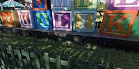
Mele Kalikimaka is Hawaiian for Merry Christmas. Covering many blocks of downtown, the Honolulu City Lights displays are a popular attraction through the holidays.
Me ka Hau'oli Makahiki Hou!
Click here for more panos from Pat.
Location
Lat: 21° 18' 15.16" N
Long: 158° 52' 21.47" W
Elevation: 3 meters, 10 feet
Precision is: High. Pinpoints the exact spot.
Equipment
Canon 40D, Sigma 8mm, Nodal Ninja 3.
 Tap or click the zoom icon in the bottom right corner of the picture to switch between in-page and fullscreen view